May 2024, 6 nights
 |
| Cades Cove loop in Smoky Mountains National Park |
We had originally thought we would stay in Look Rock Campground to visit the Smoky Mountains because it is the only National Park campground with electricity, and we wanted to stay for about a week. After more research, we decided to go with Cades Cove Campground instead. One reason we changed our minds is because there is more hiking directly from the campground in Cades Cove, and we had read there is a lot of vehicle noise by Look Rock from Foothills Parkway.
 |
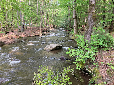
| Above: Abrams Creek across from campsite Below: campsite 68 in Cades Cove Campground |
Cades Cove Campground, campsite 68 and more
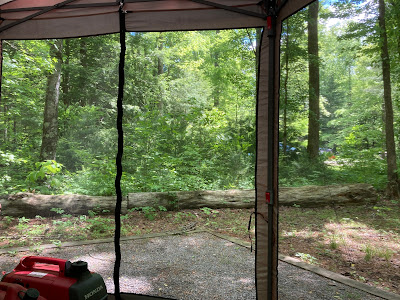
I had about six campsites as top choices in Cades Cove. Campsite 68 was on this list, although it was not near the top of the list. Some of the other sites on our list were 21, 42, 69, 70, and 79. Lucky for us, most of the other sites had been reserved by the time we could make our reservation (6 months in advance). After we got to the campground, we decided campsite 68 is one of the best sites in loop B! 😄
 |
| Above: view of campsite 68 from road in Cades Cove Campground Below: looking toward campsite 69 from campsite 68 |
 |
| Above: trail from Cades Cove Campground to Abrams Creek Below: Abrams Creek from Cades Cove Campground |
Cades Cove is a primitive campground with flush toilets, fresh water spigots by the restrooms, and a sanitation station in loop C. Generators are not allowed in loop C, so if you are not going to run one, I suggest that loop. The creek water was pretty high during our stay, and we could hear it on our campsite. This was nice, as it helped muffle some of the generator noise.
Cell service in most areas of Smoky Mountains National Park is non-existent. Free wifi was available in the amphitheater behind the camp store; however, it did not work well, if more than four or five people were using it.
 |
| Little River along Laurel Creek Road |
Hiking, biking, parking, and more
Smoky Mountains National Park is free to visit; however, if you want to park for more than 15 minutes, there is a daily parking charge now. Since we paid $80 each for our lifetime visit passes, it would make more sense to us, if they just charged an entrance fee like most parks, instead. We received several notices about this parking charge before our trip with links and suggestions to purchase one beforehand. Passes can be purchased for the day ($5), week ($15), or annually ($40). Since we were not 100% sure which places we were going to visit, we waited until we arrived. It was a good thing we did, because we did not end up needing a vehicle parking pass at all. Following are some of the activities we enjoyed.
 |
| Above: Cades Cove Loop map Below: Abrams Falls Trail in Cades Cove Loop |
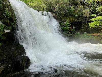
Cades Cove Scenic Loop is closed to vehicles on Wednesdays, so we biked the loop from our campsite on Wednesday. The bicycle portion of this trip was nearly 12 miles, and the route is hilly. Most people rode electric bikes; however, our bikes are pedal power only. We rode back to Abrams Falls Trailhead this day, and hiked to Abrams Falls, as well. This hike is moderate, and it took us about 2½ hours. Since most people were biking instead of hiking, we saw only three people on our hike.
 |
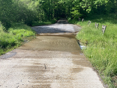
| Water across Sparks Lane in Cades Cove Loop |
We got caught in a storm about half way through Cades Cove Loop on our bikes, and then the loop was closed the next day due to flooded roads. It reopened on Friday, although there was still water across the roads in a few spots. We were walking the loop that day, and had to remove our shoes in three spots.
 |
Nature Trail in Cades Cove Campground |
We went on three hikes that we started from our campsite: Nature trail inside the campground, which starts in loop C (short and easy), we hiked Anthony Creek Trail to Bote Mountain Trail, which starts in the picnic area near the campground, and we hiked part of Cades Cove Loop on Friday when it opened back up after the rain.
 |
| Above: Anthony Creek Trail Below: Anthony Creek alongside trail |
Although Anthony Creek Trail was wet from the rain in spots, we were able to travel this trail without removing our shoes or getting them wet. This is a moderate hike up the mountain. We passed a few people on their way down, although we only encountered two other people who were going up the mountain, like we did. One person we talked with told us he had been dropped off at Clingman's Dome a few days earlier, and was hiking down the mountain. Our return to the picnic area after we reached the top was much easier than our climb! It took us almost 30 minutes longer to hike up than it did to hike back down.
 |
| John Oliver Place in Cades Cove |
We decided to drive Cades Cove Loop one evening, since we had gotten rained out during our bike ride, and we did not go through the entire loop when we walked it. When we walked the loop, we crossed over on Sparks Lane, and also walked to John Oliver Cabin.
 |
| Stuck in traffic in Cades Cove Scenic Loop |
Driving the loop was a huge mistake. We cut the drive short by crossing over at Hyatt Lane, and this trip still took us 3½ hours. After we had been traveling for over an hour, I suspect traffic had been backed up to the entrance, as a ranger came by in a small car with flashers to pass everyone and get the stopped vehicle(s) moving. There are many signs saying to pull over and NOT to stop in the road; however, I suppose this type of etiquette does not work with everyone.
 |
| Above: bear in Cades Cove Campground in Smoky Mountains NP Below: deer on Bote Mountain Trail in Smoky Mountains NP |
We had a couple of bear sightings; however, we did not get any great pictures. The bear in the photo above was in the campground our first day. We saw a couple in the loop, and we had a deer walk around us when we stopped on Bote Mountain Trail to have our lunch. Many turkeys walked through the campground during our stay.
 |
Little River and Bote Mountain Tunnel on Laurel Creek Road in Great Smoky Mountains |
Townsend, Tennessee
We visited a few places in Townsend after the heavy rains and storm. We stopped at a few of the roadside stops along Laurel Creek Road on the way there and back to walk for a bit and check out the flooded river. Just not for more than 15 minutes at a time!
Townsend has a nice Visitor Center with complimentary local coffee, and there is no charge to visit Little River Lumber Company Museum. Company Distilling has a good selection of mixed drinks and beer.
 |
| Townsend/Sunshine Covered bridge Below: flooded tunnel along Townsend Historic Trail |
Townsend Historic Trail is a nice trail that runs along Little River for a ways, and it passes by several businesses on both sides of the road. You can usually cross the parkway via the underground tunnels; however both tunnels were flooded the day we were there.
 |
| Abrams Falls in Cades Cove Scenic Loop |
Misc. and overall
There is a lot to see and do in Smoky Mountains National Park, and one could easily stay busy for a week. This park was pretty busy most days, even though we visited in early May. We had a tornado watch overnight when the storm came through, which was the evening after we got caught in the heavy rain on our bikes. A couple of tornados touched down nearby, and many roads were flooded the next day. Although we had no cell reception or TV channels, we were able to pick up a local radio station in the campground to hear the news. We enjoyed our campsite and our hikes; however, this park was too crowded for us. It was not one of our favorite national parks.
 |
| Hike board by the camp store in Cades Cove Campground |
Remember to check put the Facebook album for more details. Let me know if you have any questions, and feel free to share this post for others!


No comments:
Post a Comment